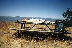
Lying down on the job again. No wonder it takes them all day to walk a few miles.
|
Lying down on the job again. No wonder it takes them all day to walk a few miles. |
After many miles on winding Mt. Hamilton Road, Edwards Trail in Joseph B. Grant Park was a welcome change. About a mile along the trail, a junction signed by a blank post appeared. All the Ridge Trail directions were rubbed off. I knew the signs were erected fairly recently; the trail was dedicated only about 18 months ago. Looking at all the cow pies nearby, we concluded that the cows must have been rubbing themselves against the post.
Spring weather was finally with us to stay. Under clear skies, we lazed around the picnic tables at the 2,457-foot vista point. Towards the west, we could see the high peaks of Loma Prieta and Mt. Umunhum.
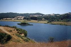
That island looks like a perfect spot for lunch. Too bad there aren't any kayaks around. |
As we made a loop through the park, several wild pigs came into view near park headquarters. These wild pigs didn't seem to like wilderness too much; they preferred asphalt. We then detoured around beautiful Grant Lake and did a little cross-country travel to get back to the beginning of the Edwards Trail. We had hit another Ridge Trail section that didn't connect to anything yet.
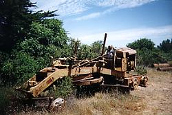
I think I'll fix this trail myself |
After leaving Grant Park in the Diablo Range, we set out in a westerly direction for the Santa Cruz Mountains. The Santa Clara Valley lies between these two ranges. The presence of this large urban area is a real challenge for the Ridge Trail route.
We hadn't gone more than a mile along the Coyote Creek Trail when we were confronted with a "trail closed" sign. We had no idea what alternate route we could take. Besides, we were supposed to rendezvous with Jean Rusmore and her hiking group coming from a side trail further ahead. So we just ignored the sign and continued on. Happily, there was no equipment being used that day and the trail was easily passable.
Jean's hiking group, called the "Walkie Talkies", comprised 22 friendly, older (the politically correct word for which I do not know) women. Bob and I had a great time walking and chatting with them. And why not; after all they were the walkie talkies.
Hiking through Santa Teresa Park and walking quite a few miles on roads, we arrived at the foot of the Santa Cruz Mountains. The next day, Joy, Bob, and I began our climb to the ridgetop of the Sierra Azul in warm weather. We each had started with four quarts of water. By the time we had climbed one thousand eight hundred feet to the top, almost a third of our water was gone. The trail down to Lexington Reservoir was wide, very steep and rocky. Like the Lawndale Trail in Annadel State Park, this trail was in need of repairs.
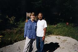
They do look like they've walked a few miles today |
Reaching the reservoir, we had lost all the elevation gained in the morning. We then crossed Highway 17 and began our climb of two thousand five hundred feet to Skyline Blvd. We walked along Black Road, a narrow, winding but somewhat shaded road. We stopped for the day just north of the Sunnyvale Mountain picnic area. All out of water by then, we were still elated to be standing near the highest point on the Ridge Trail. The Ridge Trail route is at just over 3,000 feet in that area.
Hike for the Ridge Trail Home
Album Page 1
Page 2
Page 3
Page 4
Page 5
Page 6
Page 7
Dinesh Desai Home
Send email to Dinesh
Copyright © 1998, 1999 Bay Area Ridge Trail Council