Henry W. Coe State Park vs The Desais
And the winner is ...
Site Navigation
The End
Several times during our hikes, we chanced upon rangers Barry Breckling and Cameron Bowers. Initially, they may have been skeptical about our commitment and ability and with good reason. Over the weeks, however, I could sense that they were really warming up to us. I discussed our predicament at not being able to use the Dowdy Entrance and asked Cameron if he could ask Mr. Ferry, the chief supervising ranger, who had denied our original request, to reconsider it. I was pleasantly surprised when he informed me that Mr. Ferry had left it up to him and that he would allow us to use that entrance. I said 'pleasantly surprised' because, as everyone knows, the structures of government entities and large corporations inhibit their employees from going out of their way to solve someone else's problems.
In the first week of June, we entered the park thru Dowdy gate, car camped at Pacheco Creek and hiked 67 more miles to bring our total to 457. More interestingly, it brought our total elevation gain close to 100,000 ft. This means that unless you are hiking a few of the easy trails, on the average, expect a climb of at least 2,000 feet on any 10-mile hike in this park. No wonder it is nicknamed 'Killer Coe".
Kaiser Aetna Road
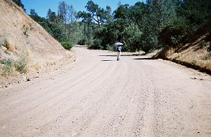
Traffic jams would be a thing of the past if all the roads in the country were as wide as this Kaiser Aetna Road
|
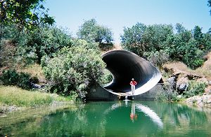
This Pacheco Creek culvert on Kaiser Aetna Road can probably handle a flood of Biblical proportion
|
So why is this road so wide and the culvert under it so strong? In the 1970s, the development firm Kaiser-Aetna had planned a large subdivision in the area and had built this access road. However, the project hit some roadblocks and eventually, the land was bought out and given to the park.
Our last hike from Pacheco Creek, a 20 miler, took us all the way to Red Creek Road in the Orestimba Wilderness. With that, we had finished hiking all the trails in the park except about 50 miles north of Red Creek Road. It had taken us 40 days. We had done 12 day hikes and 28 other hikes from various camp sites. Though only 50 miles remained, because of the remoteness of the area, a ten-day backpack was called for.
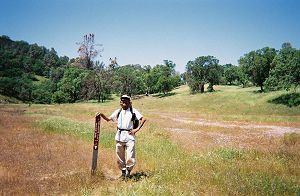
Chaparral Trail junction-Orestimba Wilderness
|
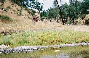
Long Ridge Road junction-Orestimba Wilderness
|
It was already the second week of June and the mercury was rising by the day. Still, we could handle the heat with adequate water. Some years ago, Joy and I walked the 180-mile length of Death Valley, in the daytime in July, and survived to tell the tale, but only by consuming 3-plus gallons of water each day. Robison Creek, which usually dries up by mid May, may still have had some pools of water, but bushwhacking many seldom-used, steep trails in the heat would have required a lot of effort and consequently, a lot of water. Unfortunately, there aren't too many reliable water sources along many of the trails. My experience on the day hikes from Mississippi Lake had me convinced that, during the day hikes, replenishing our water would definitely be required. I am an adventurer, but not a maniac. The odds of successfully completing the backpack were against us. It wasn't an easy decision, but in the end sanity prevailed and we decided to be satisfied with what we had accomplished.
Dinesh Desai
June 2006
(Epilogue: In the next three years, we managed to hike most of the 50 miles of trails we had missed. We hiked the trails during 'backcountry weekends' and certain sponsored outings.)
The next page is "My affair with Henry" by Joy.
The story of Dinesh and Joy's Death Valley trek is here.
Henry W. Coe State Park's official web sites are here and here.
Site Navigation