Our joggers worked well ... |
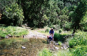
except that they sometimes got our boots wet |
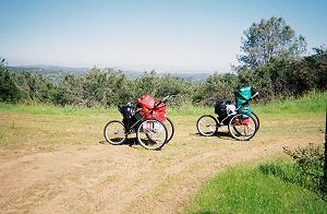
We both enjoy hiking and even strenuous mountain climbs, but not backpacking. We are both small in stature and a 40-pound pack is just about our limit. Ask us to carry a 50-pound pack on steep terrain and you may hear some expletives not usually in our vocabulary. Our planned six and seven day backpacking would result in 50 to 60-pound packs and I had to come up with an alternative to lugging such heavy packs. After some research and experimentation, I settled on the idea of using a baby jogger. We bought two joggers with 24-inch rear wheels and removed their canopy, seat etc., so that only the frames remained. A trial run with a 60-pound load on hilly terrain convinced me that the jogger was indeed a viable alternative.
|
Our joggers worked well ... |
except that they sometimes got our boots wet |
Every year, during one weekend in April, a limited number of day hikers and backpackers are allowed to enter the park's backcountry thru the Dowdy gate. An additional advantage of this so called Backcountry Weekend is that one can drive several miles beyond the gate, thus reducing the distance needed to backpack. My original plan was to hike the trails in the backcountry Orestimba Wilderness by backpacking a 13-day loop. Starting on the backcountry weekend, we would start off with a seven day supply of food and fuel. A week later, a couple of our ultra runner friends would enter thru Dowdy gate with more food and fuel and make a 30 mile day trip to resupply us. Unfortunately, the plan had to be shelved as access thru Dowdy gate was not possible.
During the Backcountry Weekend, under my hastily revised plan, we joggerpacked to Mississippi Lake rather than to Paradise Lake in the Orestimba Wilderness. Since we intended to spend six nights at the lake, we had our son drop us off as we wouldn't have been able to drive out. It was wonderful camping at the lake. After the weekend, we were the only ones there and the solitude and the vistas gave us an unforgettable experience. The day hikes took a toll, though. The spring rains had stopped and the daytime highs hovered in the eighties. I had increased our average hike's mileage from 11 to 13 in order to hike as far in the Orestimba Wilderness as we could. In spite of our carrying seven quarts of water between us, on many days, we had to replenish our supply from a creek or a spring.
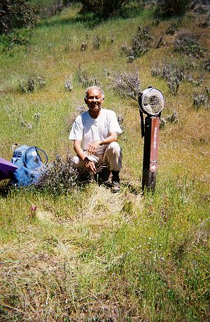
No, that's not our canteen. It was permanently fastened to the post (inscribed with the word 'Spring') to indicate that Canteen Spring is to the right.
We stayed hydrated, but were unable to replace lost sodium and other electrolytes. Since our first hike on March 19, there was a lot of rain with cool weather. When I was preparing for the backpack trip, my main concern was how to cope with rain, not how to deal with warm weather. As a result, I had left my salt shaker home and neglected to bring any electrolyte replacing powder. And there was no way to get it at the lake. On subsequent backpack trips, we took a large salt shaker, Gatorade and a big bag of potato chips. I would salt even my oatmeal in the morning, but still, the salt deficiency persisted. The potato chips never tasted salty. Many years ago, I may have bought salt tablets. But then the new research showed they were unnecessary and maybe even harmful. I am now convinced that there are occasions when the old fashioned salt tablets are useful.
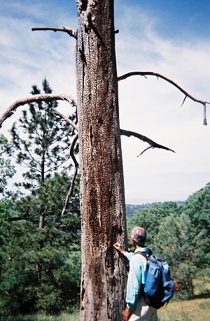
The warm weather brought out the rattlesnakes too. One incidence left Joy quite shaken. No sooner had she taken ten steps from Pacheco Ridge Road onto the narrow Dog Trail, when she encountered a rattler in an attack mode. It had its mouth wide open and was rattling furiously. She hastily retreated only to trip on some tree roots. I hurled some rocks at it, not an easy feat throwing them around a corner, and eventually got it to move a few inches into the bushes. It still was rattling when we hurried past. Later the same day, we saw a huge rattler crossing the trail, but it was quite docile and presented no problems. Regardless, we enjoyed exploring the area, as we had never hiked most of the trails before. We saw several foxes and deer that weren't used to humans. It was a sight to watch big bucks running gracefully at high speeds. Joy is a naturalist and found interesting new flora and fauna. She observed that, surprisingly, there were no critters near our campsite looking for food; no squirrels, ants or birds.
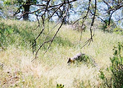
A gray fox
We left our tent, joggers etc. at the lake and hiked out to the headquarters entrance with dirty clothes and garbage in our day packs. A couple of days later, we were back at the headquarters with our friend Steve in tow. I had recruited him to carry our seven day food supply, about 18 pounds, to Mississippi Lake and return to his car the same day. He made the round trip, 22 miles with a 5,000-foot climb, with a big pack on his back and a smile on his face. Yes, my friends are masochists too. Actually, I don't know if he was still smiling at 9 PM when he returned to his car, but I for sure, wasn't smiling at the end of the day. I took a tumble on Willow Ridge Trail, en route to the lake. It hurt a little to walk but then, in a field adjoining Willow Ridge Road, we came across a big red metal ball. Wondering what that could be kept my mind occupied and away from the pain. But, by the end of the day, my leg was quite swollen. From the lake, we moved to Pacheco Camp. This camp is used by various groups, and as such, it had good amenities. Several large trees provided much needed shade. It also had picnic tables and a sink with running water piped from a spring. Alas, the water still needed to be purified. Even with our efficient 'First Need' water filter, we pumped for roughly half an hour every day.
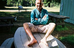
Dinesh's swollen leg. A few days later, as the swelling moved towards his ankle, he had trouble putting his boots on. |
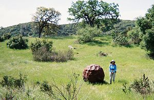
No, the Martians haven't landed. In bygone days, a tractor pulled this giant steel ball alongside the road to remove shrubs. |
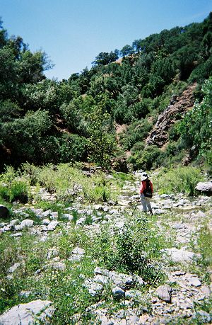
We had never hiked any of the trails in the vicinity of Pacheco Camp, and every morning, I felt a little nervous. Doing a loop hike meant that it was absolutely essential that we find the trails or risk backtracking many miles. Some of the trails were easier to follow going in one direction, but not so in the other. One day, we had an arduous hike on Mudd Spring Trail, the last half a mile of which follows Mississippi Creek. It took us a long time to weave our way thru boulders, fallen trees and high water, but eventually we made it to its end at Coit Road. It was getting late in the day, but we were only a couple of miles from the camp. We started on Phoneline Trail and after just 50 feet we lost the trail. After spending half an hour, we still had no luck finding the continuation. Thankfully, we had the option that day of following Coit Road back to the camp. I shudder to think what we would have done if we had to retrace the trails that had taken us seven hours to negotiate. We eventually did hike Phoneline Trail starting at the other end. As we neared its end at Coit Road, it became clear why we had not found it the first time. A large fallen tree intertwined with poison oak had completely obliterated the trail.
We spent four nights at Pacheco Camp and then moved to Blue Tank Spring. The latter isn't a good camping location, but it was centrally located for the hikes we had planned to do. The toughest and the most time consuming hikes were the ones along the creeks. Because of the high water level, the best way wasn't always readily apparent. And, there were plenty of fallen limbs waiting to break our limbs. We were running late one day and were forced to skip the 1.6-mile Kelly Cabin Canyon Trail. A couple of weeks later, we did a 15-mile loop from the Coyote Creek entrance just to hike that missed 1.6 miles. And yes, we did temporarily get 'lost' on a few occasions, but by using the park map and my GPS receiver, we got back on track. Our last joggerpacking was for four days to Los Cruzeros, and with that, our completed mileage climbed to just under 400.
That looks too steep and overgrown for a trail |
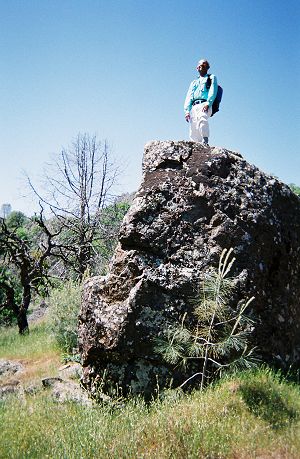
Dinesh still can't see where the trail is |
But getting lost was no big deal; we could have lived off the land.
Plenty of acorns and ... |
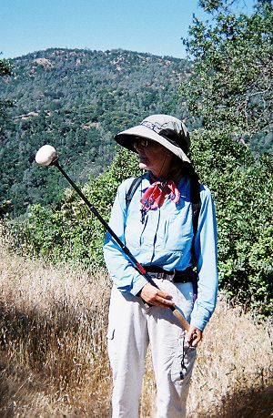
marshmallows too |