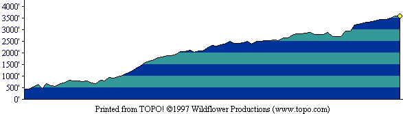
This profile shows the first half of the out-and-back route. [ More info about elevation profiles. ]
This page describes the specific hiking route used on Rose Peak for Everest by the Bay.
All distances and elevations are approximate [ more info ].
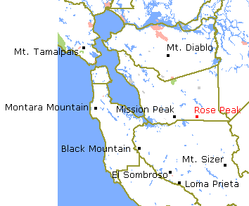
From Interstate 680 in Sunol, take the Calaveras Blvd. exit. Follow Calaveras about five miles south to Geary Road and turn left onto Geary. (The road a little before Geary Road is Welch Creek Road.) Continue on Geary Road to the Sunol Regional Wilderness Area entrance kiosk (pay for parking here, and purchase a permit if you do not have one). Follow the paved road to the loop at its end and park. The trailhead gate is at the far (south) end of the parking area. Note: this trailhead is not the one used by most Rose Peak hikers because this route does not follow the Ohlone Wilderness Trail at first.
Follow Camp Ohlone Road south across the bridge and then eastward through the "Little Yosemite" area. Soon after passing the signed "W Tree", turn left onto Backpack Road. Follow this road up to the north and meet the Ohlone Wilderness Trail, where you go right (east). Follow Ohlone Wilderness Trail, whose route is marked along the way by disks bearing a red oak leaf, all the way to Rose Peak. Return along the same route.
This profile shows the first half of the out-and-back route. [ More info about elevation profiles. ]