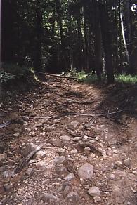
This is what passes as a trail in some state parks
|
This is what passes as a trail in some state parks |
We reached Annadel State Park around noon. After lunch, Howard said goodbye to us and we continued on the Ridge Trail towards the east end of the park. Just before starting on the Lawndale Trail, we stopped to chat with a couple of bikers. Soon, we were joined by a young woman who had biked up the Lawndale Trail. She was pleased to meet the "celebrities"; she had seen us on the Santa Rosa TV channel.
Lawndale Trail was steep and uneven. Descending, Bob fell and a stubby branch jabbed him in the ribs. Though he didn't fracture any ribs, it hurt for a couple of weeks just to take a deep breath.
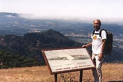
A bald man on his namesake mountain |
Early Monday morning, we headed towards Bald Mountain Summit in Sugarloaf Ridge State Park. Bob tried to take a picture at a scenic spot only to find that his camera had stopped working. As we approached the next vista point, we couldn't believe our luck; hanging from a post was a camera. We took it with us after shooting a picture to make sure it was working. Soon we arrived at the summit of Bald Mountain. At 2,729 feet, it was the highest elevation achieved so far on this hike.
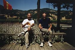
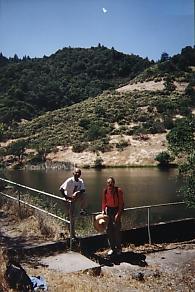
All work and no play make Dinesh and Bob dull boys |
We retraced our steps to Highway 12 and the Adobe Canyon Road junction where we had started in the morning. One of our "rules" was to walk all or a substantial part of each dedicated (opened to the public) Ridge Trail section. Since the trail in Sugarloaf State Park did not connect to any other trail that we could use, our six hours of walking and 2,500 feet of climbing resulted in a no net advance in our journey.
We then headed south on Highway 12. After passing two wineries, we decided to take in a bit of Sonoma Wine Country by stopping and tasting a cabernet made by the Smothers Brothers Winery.
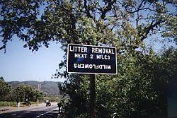
Highway 12 mystery. We don't know what the sign means. Do you? |
Looking up the State Parks' phone number at the winery, we called to let them know we had found a camera. A ranger put us in touch with the woman who had reported it lost. She lived close by and came looking for us as we walked Highway 12. Being very thoughtful, she brought us some lemon drops and even offered money to buy some wine. Though we declined the money, we asked her to mail the pictures we had taken with her camera.
If you can find farms in Berkeley, we certainly can find trails in Napa |
Napa County with its vineyards is not built up like other Bay Area counties. Unfortunately, it also has very little public open space. In fact, the county does not even have a Parks Department. Trails are few and far between. Thus, it was a welcome relief to road warriors like us to hike on a trail from Dry Creek Road to the Veterans' Home on Solano Avenue in Yountville.
Hike for the Ridge Trail Home
Album Page 1
Page 2
Page 3
Page 4
Page 5
Page 6
Page 7
Dinesh Desai Home
Send email to Dinesh
Copyright © 1998, 1999 Bay Area Ridge Trail Council