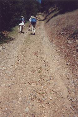
A short cut usually means an alternate to a regular trail with a steep ascent or descent. Here we are on a road called "The Short Cut" ... but it is the only way to get up to the ridge.
page 4
|
A short cut usually means an alternate to a regular trail with a steep ascent or descent. Here we are on a road called "The Short Cut" ... but it is the only way to get up to the ridge. |
We usually averaged a pace of two miles per hour, including lunch and other breaks. That was a little slow for some. It was interesting to observe the pace at which different people walked. A few strong hikers -- Ron, Steve, Joy, Curt -- usually hiked in the middle or the back, whereas others -- Carol, Sandy, Dave -- almost always stayed in the front. But they didn't know the route and had to wait at trail junctions for the rest of the group. By the way, Dave, whom I hadn't mentioned before, had joined us on day two to hike five days.
Henry Coe State Park, the largest state park in Northern California, has been nicknamed "Killer Coe" by local hikers. It is possible to do loop hikes of twenty, thirty or more miles with several thousand feet of elevation gain on its vast network of old ranch roads. The terrain is steep and the temperatures routinely fall below freezing in winter and exceed 100 degrees F in summer. Our short loop called for a 15-mile hike with an elevation gain of about 4,300 feet.
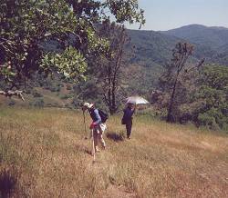
Sandy negotiating Jackass Trail as Joy looks on. Surprisingly, Sandy walked backwards just about as fast as she would walk facing forward. She was determined not to hold anybody up. |
Sandy usually hiked in the front, but yesterday, on the way down, she appeared to be hanging back. Her one knee was bothering her then and Henry Coe's steep roads aggravated it even more. She walked the first steep downhill in pain, but found it less painful to walk backwards. And that's how she walked the remaining downhills.
That evening, we discussed Sandy's situation. It was decided that unless her knee felt better in the morning it would be best for her not to attempt the twenty-mile Rose Peak hike. Unfortunately, her knee seemed to be worse the next morning. The red area around her knee cap was larger. She was devastated, as she had been looking forward for months to hiking with us in the Bay Area. I was somewhat baffled that a couple of day hikes could cause her such knee pain; especially considering the fact that, not too long ago, she had finished the rim-to-rim trail in the Grand Canyon. She reported later that her physician attributed her knee pain primarily to a bursitis flare-up.
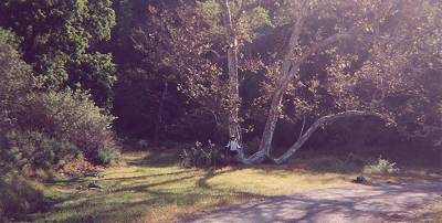
Warren in front of his tree. The W-shaped tree is a well-known landmark in this park. It marks the beginning of a side trail called "The W Tree Rock Scramble" |
Rose Peak is generally thought to be the highest point in Alameda County. However, Joy and I know better. Along with a few other misguided souls, we have been locating and climbing the highest points of each of the California counties. Setting aside modesty, I must mention that Joy and I were the first ones to locate and climb the true highpoint of Alameda County, a peak thirty feet higher and about two miles from Rose Peak. We named it Discovery Peak and the name has stuck among the many who now pursue this hobby. Patrick is among them. He has climbed thirty-eight of the fifty-eight California county highpoints, and when we reached Rose Peak he longingly eyed Discovery Peak (easily recognized because of the radio towers on its summit).
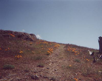
California poppies dot both sides of the spur trail to the summit of Rose Peak. |