Black Mountain Brouhaha:
Much Ado About Nothing

Maps and Routes

tiny version of the summit-area map

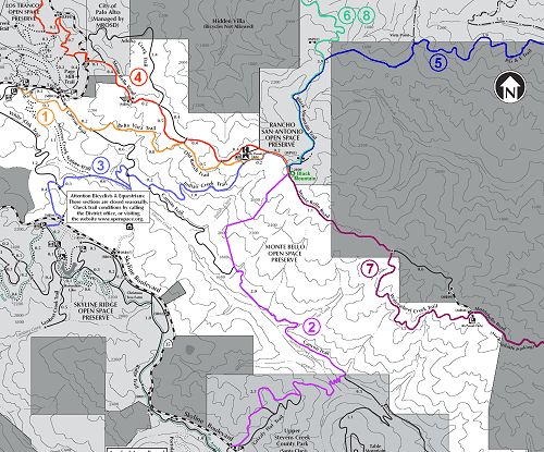
The Black Mountain Brouhaha map shows the full length of three of the routes (days 1, 2, and 3) and the upper portions of the other five. The summit of Black Mountain appears just above the center. This Web-page version is just large enough to show the basic layout.

For more detail, you may view or download any of the following:

Here is a table of the routes used to travel up the mountain on each of the eight days. The links in the Day column will take you to the descriptions of the Black Mountain Brouhaha hikes. The links in the Trailhead column will take you to pages about the parks and open spaces in which the trailheads are located.

Day Trailhead and subsequent trails locations Uphill route Round trip distance Round trip elevation gain
1 Monte Bello Open Space Preserve
  1. Canyon Trail
  2. Bella Vista Trail
5 miles 1000 feet
2 Upper Stevens Creek County Park (Grizzly Flat parking area) / Monte Bello Open Space Preserve
  1. Grizzly Flat Trail
  2. Canyon Trail
  3. scramble up south side of Indian Creek
11 miles 2500 feet
3 Skyline Ridge Open Space Preserve / Monte Bello Open Space Preserve
  1. unnamed trail
  2. Indian Creek Trail
6 miles 1200 feet
4 Los Trancos Open Space Preserve* (roadside parking near Gate LT01) / Monte Bello Open Space Preserve
  1. Page Mill Trail
  2. North Monte Bello Road
6 miles 1000 feet
5 Rancho San Antonio County Park / Rancho San Antonio Open Space Preserve
  1. PG&E Trail
  2. unmaintained trail
  3. Black Mountain Trail
13 miles 2800 feet
6 Hidden Villa / Rancho San Antonio Open Space Preserve
  1. Adobe Creek Trail
  2. unmaintained trail
  3. Black Mountain Trail
11 miles 2400 feet
7 Ridge Vineyards / Monte Bello Open Space Preserve
  1. Waterwheel Creek Trail
  2. South Monte Bello Road
7 miles 1000 feet
8 Rancho San Antonio Open Space Preserve (Windmill Pasture area entrance)
  1. Rhus Ridge Trail
  2. Black Mountain Trail
10 miles 2400 feet

* The actual Day 4 hike began in Arastradero Preserve and covered 18 miles with a 2800-foot elevation gain. Because part of this route is not open to everyone, the full route is not described in this table.